- Home
- About
- Rider Info
- Ride Information
- 2016 Ride Routes
- More Rides
- Local Bike Shops/Resources
- Weather
- Where to Stay
- Camping
- What to do
- FAQs
- Past Rides
- 2016 Registration Form
- Eat Well
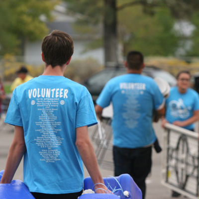
- Volunteer
- Sponsors
- News
- Give Back
- Shop
32
Days Til 2016 Ride


2016 Edible Pedal 100® Registration Fees
Ride with us on: September 18, 2016

Registration opens January 2016
Tandems are welcome,
but registration fees apply to each rider.
Registration opens January 2016
Tandems are welcome,
but registration fees apply to each rider.
Donate to the Edible Pedal 100
Sponsors:

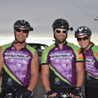
Check Out the 2014 Ride!
We've got great photos from:
|
Jon Greene
|
|
Chris Rose
|
A big thank you to our awesome photographers!
Any chance of you putting this on a Google Maps or MapMyRide.com interactive format?
We just added a 3D map (http://www.ediblepedal100.org/routes/) and we will be adding a Google Map in the next couple weeks. MapMyRide.com looks like good idea – I’ll see about creating a map there too.
On the route map, I don’t see a road connecting Murphy Road with Longview Road, coming off Ash Canyon, at the north end of the route.
Thank you for contacting us. We are still working with law enforcement and NDOT on finalizing the route. We’ve had a few suggestions on getting through Carson…some conflicting. We’d love your thoughts if you have a preference.
Again, thank you for the feedback.
Responding to Leo’s question, the connection between Comb’s Canyon Road and Longview Dr. is a wide paved bicycle/pedestrian path running behind the Western Nevada College campus.
The proposed southbound route through Carson City appears to go out onto U.S. 395/S. Carson Street shortly before the U.S. 395/Westbound U.S. 50 intersection, this is a very dangerous area. There is virtually no shoulder in combination with a high speed right hand lane from southbound 395 to westbound 50. I would avoid this like the plague.
A better route would be from Curry, turn left on Clearview, cross over 395 and continue on to the intersection with Silver Sage. Turn right on Silver Sage, south to Appion. Right on Appion to a slight right on Snyder. From Snyder, left onto Lupin, which serves as the east side frontage road for 395. Continue on Lupin to the intersection with 395 and Old Clear Creek Road. This intersection has a traffic signal, which provides a safe left turn onto 395, and there is a wide shoulder at this point up to the Jacks Valley right turn.
At least parts of this route are NDOT’s 395 bicycle route. The downside is that there are three high-speed right turn intersections into the various commercial properties on the west side of 395–WalMart, Borders, Best Buy, etc. When riding alone, I turn into the first right at WalMart, ride through the roads connecting the parking areas and back out at Best Buy. Not sure if that is practical for a large group.
On a slightly different subject, given a choice I’d prefer to ride up Spooner (except for the lack of shoulder on the approach) and down Kingsbury. The reason is that the uphill side of Spooner has a nice wide shoulder, and except for a few ugly drains, it is a nice ride. The downhill side of Spooner has a narrower shoulder with drains that require one to turn out into the travel lane in order to avoid. Riding down Kingsbury is much more bike friendly. Not sure how to accomplish this reversal. This is just my personal assessment from experience.
Use the terrain version of Google maps, greatly enlarged, to actually see the suggested routes and to view the shoulder widths in various areas.
James, thank you for taking the time to share your comments. It is our goal to provide a safe and enjoyable ride. To that end, we just received our stamped Traffic Control Plan and will be meeting with NDOT to review the route again. We are open to suggestions and will certainly add yours to the mix. Again thank you, we look forward to seeing you in September.
@Allie – I apologize for not getting back to you sooner. There is a time limit – riders can basically take from sunup to just before the BBQ (or sundown) – we’ll be sending out vans to collect riders at that time. Would that time frame work for you?
Chris – that is a great idea. We just created a discussion thread on our facebook page for solo riders (http://www.facebook.com/topic.php?uid=181212238557420&topic=276) we’ll start promoting it and see if we can help you connect with some other riders. Go ahead and post your inquiry there.
I took the liberty of doing the mapmyride course. Here it is: http://www.mapmyride.com/routes/view/45330968/
Thank you, Nico – that was very helpful of you!! We are working to get the actual route and sections (10, 50 and 100mile) set up with map my ride this week. We will keep you posted!
Elaine – we are working on getting a specific map created for mapmyride.com (should be done by the end of this week), but for a general idea, Nico put in the basics and you can see it here: http://www.mapmyride.com/routes/view/45330968/ Thanks, Nico!
Bill – You are absolutely correct on the mess right now. Update: We are talking to the contractor, Peek Construction, on a regular basis. There will be no lane closures on ride day. Because there are no weekend closures, they are required to have the site clear of vehicles and equipment. Peek is aware of the ride and has assured us they will do everything they can to ensure the road is obstacle free and rideable. We will continue to work with Peek Construction as they near the end of their project and keep riders updated via our website and rider emails.
We noticed some issues with the MapMyRide map that we posted, so we have removed it. We want to make sure only the correct route is shown so no one is confused! We will keep you posted!
I will be doing the 100 but want to skip the part into Minden and jump right into the grade. Knowing it wont be a full century, but still a brute of a ride for a 55 yr old who has to work for a living